
Sherman Neighbors by Block
Public sources describe a block in layers. The county map establishes parcel geometry. GCAD and the county tax search provide appraisal or tax-account context. Historical directory pages and Sanborn maps can add a date-specific picture of addresses, businesses, vacant places, and structures. None of those sources creates an official current list of Sherman neighbors, and a public owner field is not proof of occupancy.
| Source | What It Shows About a Block | Access |
|---|---|---|
| County parcel GIS | Adjacent polygons, parcel IDs, address points, lot, block, and subdivision context | Public ArcGIS identify and query |
| GCAD | Public owner and legal-description fields for a selected parcel | eSearch by ID, address, or owner, with tax-year context |
| County Tax Search | Mailing address, situs, account, and pay-status context | Online parcel search, not a household roster |
| Directory street pages | Historical occupants, businesses, and vacant places by number | Portal, library, and TSLAC holdings |
| Sanborn maps | Structure use and street or block geometry on the map date | LOC, THC, or library holdings |
| HOA certificates | Community association or management-contact lead | Texas certificate search, not a member list |
Use a source only for what it documents. An appraisal record can point to a parcel owner. A directory can place a published entry at an address in its publication year. A map can show adjoining geometry. Keeping those labels separate protects the accuracy of a search for Sherman neighbors.
Define Sherman Neighbors by Parcel
For a GIS search, a neighbor is an adjoining parcel polygon. It is not a statement that two people know one another, share a household, or currently occupy the adjacent sites. That precise definition matters in Sherman because a parcel may have an owner mailing address elsewhere, a site address, a legal description, and an appraisal record that each serve a different purpose.
Grayson County’s interactive service provides parcel geometry and layers for city limits, ETJ, voter precincts, schools, fire and EMS, water and electric service, and other jurisdiction questions. The service supports identify and query. The public parcel layer exposes PROP_ID and GEO_ID, so those identifiers can be carried from a map click into GCAD or a narrow written records request.
- Parcel
- A mapped unit of land. A parcel boundary is the basis for this block method.
- PROP_ID
- A property identifier exposed in the Grayson public parcel layer.
- GEO_ID
- A geographic identifier exposed in the parcel layer and useful for matching a map result to appraisal research.
- Situs address
- The physical property location. It can differ from an owner’s mailing address.
Map a Sherman Neighbor Block
Start at the exact subject address in the Grayson County Public Interactive Map. The map-browse method is deliberate. Research did not locate an official radius button or automatic neighbor export, so a defensible result comes from identifying each adjacent polygon and recording the data shown for that parcel.
- Locate the subject address and identify its parcel polygon.
- Click each polygon sharing a boundary, then record the address, PROP_ID, GEO_ID, and map date.
- Open the selected parcel in GCAD eSearch and note the public owner field, legal description, and tax-year context.
- Check city limits, ETJ, subdivision, block, lot, and precinct layers before directing a records request.
- For a full street-by-street record trail, use the Sherman street directory rather than extending a block search beyond its purpose.
Each handoff should preserve the identifier and the source date. A deed party, an appraisal owner, and a person named in an old directory can all be relevant, but none should be relabeled as a present resident without independent evidence.
Sherman Neighbor Parcel IDs
The county parcel layer is more than a picture. Its REST service supports polygon selection and query, with fields including PROP_ID, LONG_GEO_I, GEO_ID, OBJECTID, and create or edit dates. Capture the displayed parcel identifiers before moving to another system. The numbers reduce mistakes when nearby lots have similar street names or an old address has changed.
GCAD’s search options include owner name, street number, street name, Property ID, Geographic ID, subdivision, and tax year. Its guidance calls for a simple street name without a prefix, suffix, or unit. A selected result can show a property ID, geographic ID, type, legal description, owner name, appraised value, and a map connection, but an appraisal result remains an assessment record rather than occupancy proof.
Note: Preserve the exact source field and tax year because an adjacent parcel’s public owner field can change after a later filing.
Sherman Neighbors and Jurisdiction
Two adjoining parcels can fall under different local contexts. City Limits and ETJ are separate Grayson GIS layers. Voter, justice, commissioner, and school precincts are separate layers as well. Sherman’s city GIS describes its map as a way to determine city-limit or ETJ status, while its comprehensive-plan summary describes roughly 47 square miles of city limits and a two-mile ETJ.
That geography helps choose the right custodian. County parcel, tax, and recorded-instrument questions follow county systems. A city permit, planning, archive, or municipal matter may depend on whether the address falls within Sherman city limits. ZIP labels do not settle that question. The Sherman GIS resource and the county map should be checked alongside the address-level postal result.
Sherman Neighbor Association Records
Community associations add a civic layer to a block search. The Texas HOA management-certificate search accepts association name, county, city, ZIP, and association type. Its results can provide an association or management-contact lead. They are not member directories, proof of ownership, or evidence that a person lives in the community.
| Association surfaced in certificate results | ZIP shown | Publicly located record |
|---|---|---|
| The Preserve at Country Ridge HOA, Inc. | 75092 | Management-certificate search result; no public member list located |
| Sweetwater Springs Phase 2 Residential Community, Inc. | 75090 | Certificate search result; no public member list located |
| Estates at Baker Park Community Association, Inc. | 75092 | Certificate search result; no public member list located |
| Preston Club HOA | 75092 | Certificate search result; no public member list located |
| The Hills of Sherman Residential Community, Inc. | 75092 | Certificate search result; no public member list located |
| Chamberlain’s Ridge HOA | 75090 | Management certificate located; no public member list located |
The search page noted that its certificate data may be incomplete. Treat the community name and ZIP as a contact-routing lead only. A certificate cannot establish who belongs to the association, owns a particular lot, or occupies a particular address.
The certificate search interface shows the available county, city, ZIP, and association-type filters used for this Sherman research.
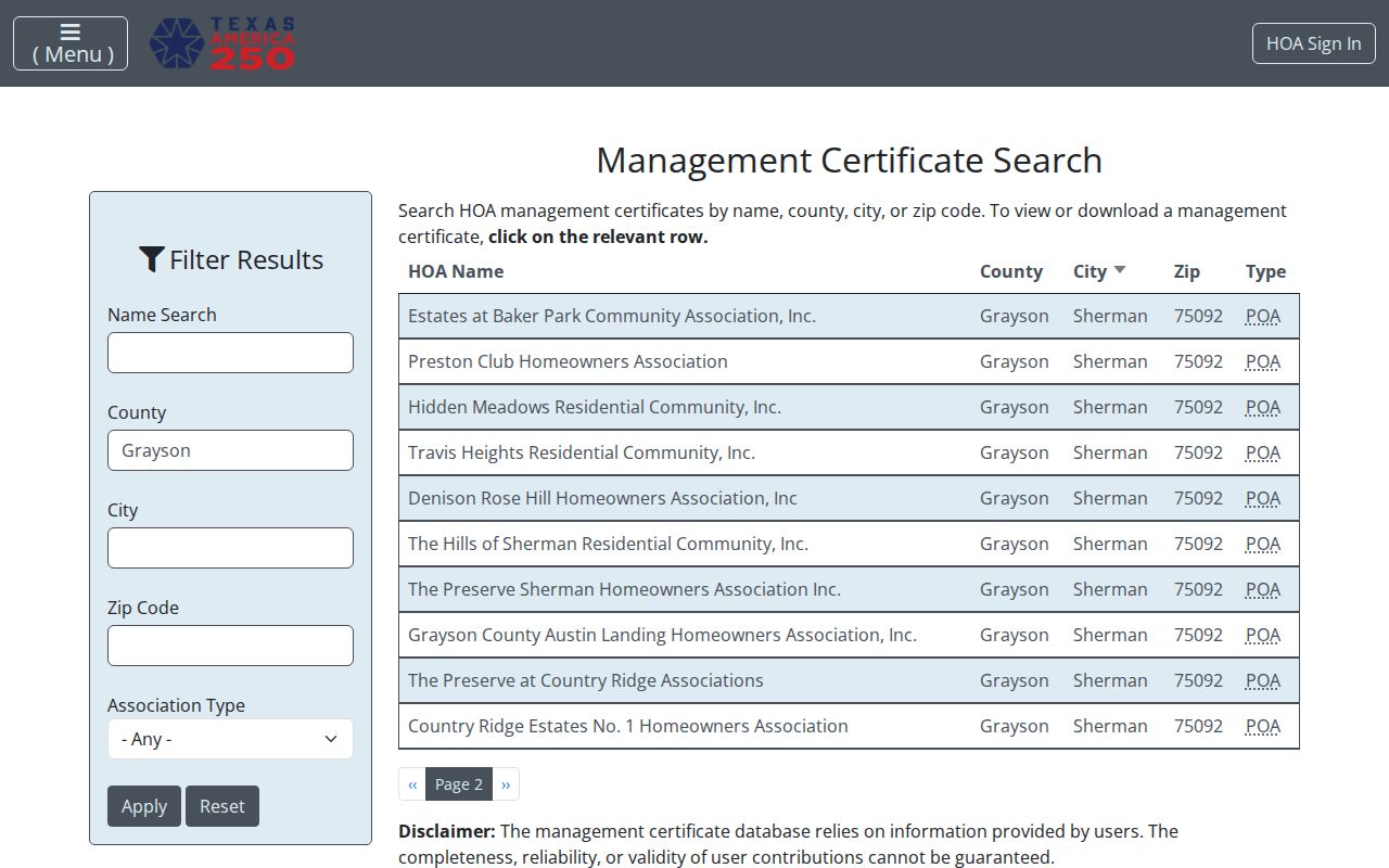
Use the public result to reach the named association or management contact about association matters, not to build a resident roster. No public member directory was located for the associations in the Sherman inventory.
Sherman Neighbors in Civic Context
Block history can also run through public institutions rather than people lists. Sherman cultural-district material names Sherman Main Street, Downtown Sherman NOW, Sherman Chamber, Austin College, and other civic or preservation partners. These organizations may help identify a public event, preservation subject, or community-history resource, but the partner list does not identify members or nearby households.
The Sherman Arts cultural-partners page is the source for the public partner context captured in the project records.
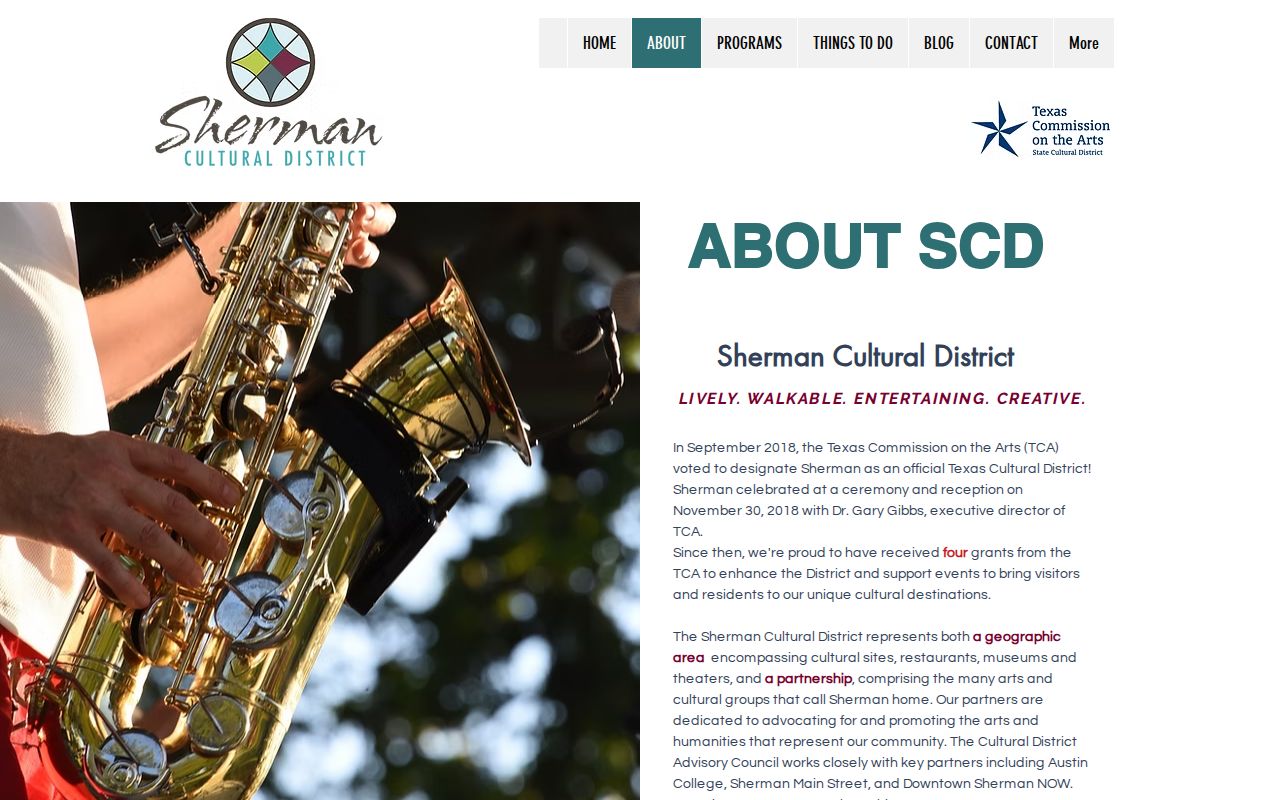
For a dated address connection, search the city archive, permits, planning, or preservation materials by address and date range. A public partner name is context, not a claim that a person belongs to an organization.
Sherman Neighbor Source Comparison
Official sources and commercial neighbor tools have different limits. The official record has a custodian, a stated coverage type, and a date that can be checked. Commercial categories may combine information from older or unrelated sources, duplicate names, and make address guesses that are not current. Neither category should be used to infer a protected residence.
| Source category | Useful question | Key limit |
|---|---|---|
| County GIS and GCAD | Which parcels adjoin, and what public parcel or appraisal fields appear? | Does not prove current occupancy or a household relationship |
| County deed and tax records | What recorded or administrative property context exists? | Mailing address, title, and appraisal owner are different facts |
| Historical directories and maps | What did a block look like at a stated historical date? | Publication lag and historical entries do not prove current presence |
| Commercial neighbor tools | May supply a lead that requires verification | Can be stale, duplicated, incomplete, or based on an unverified address guess |
Return to the custodian when a fact matters. For an address-specific city record, request only the record type and dates needed. The Sherman City Clerk request route, GCAD written request form, and County Clerk search or copy channels are better choices than a broad request for everything connected to an address.
Sherman Neighbor Block History
For an older Sherman block, pair a modern parcel with a dated directory street page and a Sanborn map. Directory entries can show occupants, businesses, spouses, or vacant places in a published year. The 1885 Sanborn record and later map holdings show structure use and street arrangement at their respective dates. Lot, block, subdivision, and legal-description details may remain more reliable than a street-number spelling.
Sherman’s 1930 courthouse fire and 1936 replacement make record survival a series-by-series question. When a current portal does not reach an older item, use TSLAC reels, the historic Kofile index, library material, or County Clerk staff to identify what survives. Record the historical source and date rather than projecting an old block arrangement onto the present day.
Sherman Neighbor Privacy Limits
Public records have boundaries. Texas voter information can include statutory public fields, but Social Security numbers, Texas driver-license or identification numbers, phone numbers, and protected-address information are confidential. Texas Address Confidentiality Program participants use substitute addressing. Do not use a parcel map, voter record, deed, social post, or nearby address to try to locate a protected person.
Grayson appraisal data also has limits, and the Texas Public Information Act does not require an office to create a new person list from its records. A narrow request for an existing address-specific record is more accurate and respects the custodian’s review process. If an exact fact cannot be confirmed in an official source, leave it as not located rather than filling the gap.
Lawful use. Use Sherman neighbor records for personal, civic, or property-history research. Do not use them to stalk, harass, or harm anyone, and stop reverse-address work when a record appears protected.