
Trace a Sherman Street by Address
A street-by-street search works best when the address is normalized first. Record the house number, the plain street name, the city or ETJ status, ZIP used, and any unit separately. Then carry the parcel identifiers and legal description forward. Grayson County systems serve different purposes, so a matching address is not enough by itself. GCAD supplies appraisal-facing parcel information, the county tax search distinguishes property location from owner mailing address, GIS supplies parcel geometry, and the County Clerk records instruments.
For a current Sherman address, use a sequence that leaves a source trail. It avoids treating an owner field, a mailing address, or an old directory line as proof that a person lives there now. The same sequence also gives a useful starting point for family history or a property chronology.
- Search the address in GCAD with the street number and simple street name. Save the Property ID, Geographic ID, legal description, tax year, owner field, and map result.
- Search the County Tax portal by Property Location. Run Owner Address separately only when a mailing address is relevant, and label the result as mailing rather than site address.
- Open the county GIS result, identify the parcel polygon, and record PROP_ID or GEO_ID plus the city-limits, ETJ, precinct, and service layers that apply.
- Use the current owner, prior owner, subdivision, legal description, and date range in the County Clerk index to locate recorded deeds and related instruments.
- When a name-based voter status check is appropriate, use Texas My Voter Portal with its required identity details and respect protected-address rules. It is not a street roster.
- For an earlier period, compare dated numerical street entries with the alphabetic directory entry and the deed chain. A historical entry is evidence for that publication date, not a current household list.
Note: Keep the search date beside every result because GCAD tax-year data, a recorded deed, and a directory publication each describe a different point in time.
Normalize a Sherman Street Address
Sherman address research can fail before a record is opened. GCAD asks searchers to use a simple street name without a prefix, suffix, or unit. The County Tax portal similarly says that its Property Location field does not require the street type or direction. Preserve the full address in your notes, but try the system’s pared-down syntax when the exact form returns nothing. Compare likely matches by map and legal description rather than relying on the first search result.
Jurisdiction belongs in the same note. Sherman’s official material identifies ZIPs 75090, 75091, and 75092, but ZIP evidence is postal rather than parcel or city-boundary evidence. A Sherman mailing label can sit in county territory or the city’s extraterritorial jurisdiction. The county map’s City Limits and ETJ layers help determine whether city permit records are likely to apply.
| Address part | What to retain | Reason for retaining it |
|---|---|---|
| Street number | Current form, older form, and unit | Directories and older instruments may use a different number or omit a unit. |
| Street text | Plain search form and complete spelling | GCAD searches work best without prefix, suffix, or unit. |
| Jurisdiction | City limits, ETJ, or county-only result | It helps choose a city custodian or a county custodian. |
| Parcel identifiers | Property ID, Geographic ID, PROP_ID, GEO_ID | These connect appraisal, map, request, and deed research. |
| Legal description | Lot, block, subdivision, survey, or abstract text | It is more durable than a street label in an older title search. |
Search Sherman Streets in GCAD
GCAD’s property search is the appraisal layer for a Sherman by-address search. Its basic guide includes owner name, street number, street name, Property ID, Geographic ID, and DBA. Advanced options add subdivision, abstract, property type, tax year, and other appraisal fields. Results can display the Property ID, Geographic ID, type, legal description, owner name, and appraised value, with Details/Map and View Selected on Map tools.
| GCAD field | Input type | Use in a street search | Format note |
|---|---|---|---|
| Street Number | Text | Narrows a street to a likely parcel | Compare candidate results by map and legal description. |
| Street Name | Text | Finds parcels on the named street | Use the basic name without prefix, suffix, or unit. |
| Property ID | Text | Returns one known appraisal parcel | Save it as a cross-system key. |
| Geographic ID | Text | Links a result to map and appraisal context | Record it exactly as displayed. |
| Subdivision or Abstract | Autocomplete | Helps resolve similar street names | Use with the legal description where available. |
| Tax Year | Selector | Sets the appraisal context for a result | Do not represent it as a move date. |
A parcel card is not a deed image and does not establish occupancy. GCAD also offers written public-information requests, with its form asking for a Property ID, Geo ID, and appraisal year. Its form cites Texas Government Code §552.149 for appraisal information obtained from private entities, including real-property sales information. Start with public parcel fields and make any follow-up request narrow.
Note: A GCAD result is an appraisal record for a tax year, so preserve that year rather than treating it as a move date.
Read Sherman Tax Address Fields
Grayson County Tax Search is related to GCAD, but it is not the same record. The portal distinguishes Owner Name, Owner Address, Property Location, Account Number, Account Type, inactive status, and paid or unpaid status. Property Location is the site or situs address. Owner Address is a mailing field and may be outside Sherman. Neither field alone identifies who physically occupied a property.
The shown account-number format includes dashes, such as 126-0586-00010. Use the portal’s Property Location option for a street search, then note whether the account is active and which field returned the address. This small distinction prevents a mailing address from being silently turned into a Sherman location. It also helps reconcile a tax account with a GCAD parcel and a recorded deed.
Map a Sherman Street Parcel
Grayson County’s public GIS map provides the spatial layer behind a Sherman address lookup. The service includes parcels, addresses, road centerlines, City Limits, ETJ, voter precincts, school districts, fire and EMS service areas, water and electric layers, and survey abstracts. Use identify or query tools to inspect a parcel rather than assuming a street address tells the whole jurisdiction story.
The GIS viewer shown here is the county’s starting map. It supports a map-first check of an address before records are requested from a city department or county office.
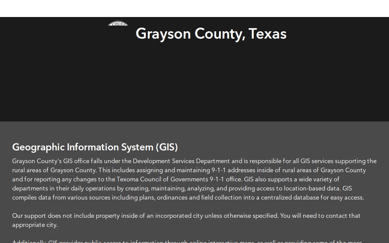
Once a parcel is identified, carry its identifiers to GCAD and the deed search. A GIS result can establish geometry and jurisdiction, but it does not by itself establish title or a current household.
The county parcel-layer record exposes polygon fields including PROP_ID, LONG_GEO_I, GEO_ID, OBJECTID, and create or edit dates. It also supports query and selection. There was no official source promising an automatic neighbors or radius export, so adjoining parcels should be examined by map browse and identify.
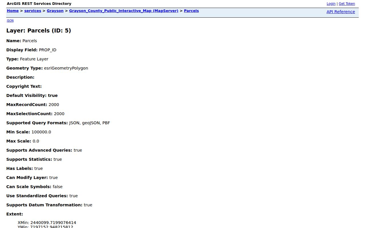
Record PROP_ID and GEO_ID with the map date. That creates a repeatable path from a Sherman street address to the appraisal and recorded-property systems.
Note: GIS City Limits and ETJ layers describe jurisdiction at the map date, not a permanent guarantee that boundaries or service responsibility never change.
Follow Sherman Street Deed Records
Grayson County Official Records Search is the current deed route, with online records stated as 1915-present. Quick Search and Advanced Search support a search term, From and To dates, recorded-date shortcuts, and a choice between Search Index Only and Search Index & Full Text. In the index, a multiword search treats terms separately. Full-text OCR can search an exact phrase. Those are different search modes, so keep the mode in your research notes.
Search the current owner as grantee for an acquisition and as grantor for a disposition. Then use the legal description, subdivision, document type, and date range to check the connection. Result fields can include grantor, grantee, document type, recorded date, document number, book or volume and page, and legal description. A person named as trustee, lender, executor, or attorney-in-fact has a role in an instrument, not necessarily an address connection.
Use Kofile Before Sherman’s 1915 Split
Grayson’s Kofile historic index is a separate route from the current official-records portal. It lets a researcher work by Type, Year, Parties, Grantor or Grantee, starting characters for last and first names, and direct Book, Volume, and Page fields. Its historic Deed Record series runs from 1846 to 1915, while other series have their own starting years.
The historic index interface is especially useful when a modern street search stops at the online boundary. Search an address’s legal description, the names on the nearest known deed, and surrounding book or volume references. Capture the instrument type and exact book reference before drawing a chain backward.
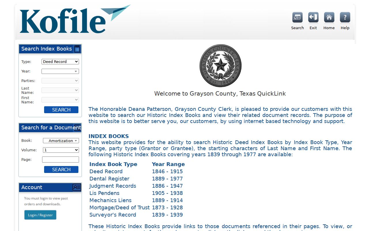
For a missing image or a pre-1915 gap, the County Clerk and Texas State Library and Archives are the next sources. Kofile and the current clerk portal are parallel systems, not one seamless database.
Read Historical Sherman Street Entries
For a dated person-to-address association, the numerical street sections in local directories are useful evidence. The 1898-99 Maloney street page includes addresses, occupants or spouses, businesses, and vacant places. The 1912-13, 1923, 1925, 1935, 1947-48, and 1950 Portal items add other dated snapshots. Read each entry literally. A spouse notation, a business listing, or r and b text describes the publisher’s convention, not a deed transfer.
Compare the street entry with the alphabetic entry and with the prior and following volume. A move, a vacancy, or a new name can reflect a publication lag, an omission, a business use, or a real change. The historical volumes and their repository details are treated more fully in the Sherman directory book.
Check Sherman Street Jurisdiction
Sherman’s comprehensive-plan material describes city limits of about 47 square miles and a two-mile ETJ. Voluntary annexations can change the boundary. A street with a Sherman mailing address may therefore fall outside city limits, even though county appraisal, tax, GIS, and Clerk records still apply. City permits, zoning, municipal court material, or a City Clerk request may have a different reach.
Save the City Limits or ETJ layer result before asking for an address-specific record. That makes a request more precise and avoids sending a city question to a county custodian, or the reverse. Postal ZIP, city mailing name, parcel geometry, and city jurisdiction should be recorded as separate fields.
Note: A Sherman mailing label and a Sherman city-limit result can differ, so keep postal, parcel, and jurisdiction evidence in separate columns.
Find Sherman Street Permit History
Sherman’s Self Service Portal launched on March 31, 2025 for building, engineering, civil, Planning and Zoning, Board of Adjustment, contractor registration, and other city processes. The city says the portal can handle submissions, status, inspection results, and payments. Its public history coverage was not independently captured, so a new portal result does not prove that earlier permit files were migrated.
For an address history that is not visible online, use the City Clerk or Development Services route under the Texas Public Information Act, Texas Government Code chapter 552. Ask for a narrow category, address or parcel ID, and date range, such as permits, inspections, planning, or archived records. City Archive categories include Building Permits, Planning and Zoning, Historical Preservation Board, Substandard Structure, and Utility Billing Inserts. Inspect the actual underlying item before treating it as a people record.
Limits of Sherman Street Directories
A Sherman street directory can connect an address with a parcel, a recorded title event, a tax account, or a dated directory line. It cannot turn those separate records into a verified current household list. An appraisal owner may live elsewhere. A tax owner address can be a mailing address. A deed party may be a lender, trustee, estate representative, or business. A historical directory is a useful published association for one year, not a timeless residence claim.
- Parcel
- A mapped piece of land identified by the appraisal district or GIS. It gives a spatial unit, not a list of all people there.
- Situs address
- The physical property location used in an administrative record. It differs from an owner’s mailing address.
- Plat
- A recorded map that lays out lots, blocks, streets, or subdivisions. It can help match an older legal description.
- Criss-cross directory
- An address-oriented directory format. No complete verified Sherman run was located, so confirm a volume with the library or repository before relying on it.
Lawful use. Use Sherman street records for personal, lawful research and documented property or family history. Do not use an address trail to stalk, harass, intimidate, or expose a protected person.