
Sherman ZIP Code Coverage
Official material associates Sherman with 75090, 75091, and 75092. The evidence is not a block-by-block delivery map. USPS Postal Bulletin material and Texas geographic coding support the Sherman association, while the Grayson County city-limits legend specifically displays 75090 and 75092. That makes each number a useful postal filter, not a promise that every address carrying it lies within Sherman city limits.
| ZIP | Areas Covered | Post Office | Notes |
|---|---|---|---|
| 75090 | Sherman-associated delivery area shown in USPS, Texas coding, and county GIS material | USPS Sherman association shown | Exact street boundary and station route were not captured. Verify at address level. |
| 75091 | Sherman association shown in USPS and Texas Geographic Codes material | Station and delivery class not located in official sources | Do not label it ordinary delivery, PO-box-only, or unique without current USPS proof. |
| 75092 | Sherman-associated delivery area shown in USPS bulletin and county GIS material | USPS Sherman association shown | Exact street boundary and station route were not captured. Verify at address level. |
The Sherman ZIP code directory therefore treats all three as associations rather than neighborhood claims. Use the USPS bulletin material as supporting evidence for the postal connection, then check the current postal result for the exact address. A ZIP result alone cannot establish who lives there, whether the parcel is inside Sherman, or which office holds a record.
Why Sherman ZIPs Need Checking
75091 deserves the clearest caution. It appears in official USPS and Texas coding sources, but the research did not locate its current street-delivery footprint, post-office assignment, or delivery category. Reporting that uncertainty is more accurate than turning an older code association into a claim about a mailbox, a route, or a city neighborhood.
For all three Sherman ZIP codes, begin with an address-level postal check and note the date. Next, locate the address in the county parcel map. If the postal label, city name, and GIS jurisdiction differ, preserve each result rather than trying to choose one by intuition. City limits, the extraterritorial jurisdiction, and postal service areas answer separate questions.
Search Sherman ZIP Code Results
A ZIP can narrow a public search before an address is known. Texas My Voter Portal directions include ZIP among the fields used with name, county, and date of birth. The result is an identity and status check, not a neighborhood roster. The county tax and appraisal systems then help turn a selected address or parcel identifier into property context.
- Use the ZIP associated with the search result as a broad filter, and enter Grayson County where the official lookup calls for a county.
- Confirm the returned address or public record with an address-level postal result before treating the ZIP as current.
- Find the parcel through GCAD or the Grayson GIS viewer, then save the Property ID or Geographic ID.
- Check city-limit, ETJ, and precinct layers before choosing a city or county records route.
- Search the appropriate custodian by the exact address or parcel ID, and label the ZIP as an as-of search result.
Once the ZIP has narrowed the area to a street, the address-specific record chain belongs in the Sherman street directory. That workflow distinguishes a parcel owner, a mailing address, and a recorded deed party instead of treating them as one fact.
Sherman ZIP Code Search Fields
The official Texas voter instructions link to My Voter Portal and describe the fields below. Use the smallest amount of personal information needed for a lawful match. A full date of birth should not be republished, and protected voter addresses must never be reverse-engineered from a ZIP or nearby parcel.
| Field | Format or Role | What It Helps Confirm |
|---|---|---|
| Name | Text identity field | Matching voter and status candidates |
| County | Selector or text used to narrow | Select Grayson for a Sherman-area search |
| Date of birth | Date identity filter | Separates same-name candidates |
| ZIP | Postal text/filter | Broad geography only, not a city-limit test |
| VUID and status | Returned result information | Registration identifier and displayed status, recorded with the lookup date |
Texas law protects Social Security numbers, Texas driver-license or identification numbers, phone numbers, and confidential voter information. A status such as suspense is not proof of a move date. For an official precinct or election-record question, contact Grayson County Elections Administration with a date range, election, precinct, and specific record type.
Sherman ZIP Code Tax Context
The Grayson County Tax Search separates owner name, owner mailing address, property location, account number, account type, inactive-account choice, and pay status. It does not offer a verified ZIP-only field in the documented interface, so do not claim that the tax portal can produce a complete ZIP list. Instead, use a known address or account after the postal check.
The recorded screenshot of the county tax search shows the distinction between owner mailing information and property location. That distinction matters when a Sherman ZIP appears beside a tax account: mailing information can be elsewhere, and a property location is still not a statement about the current household.
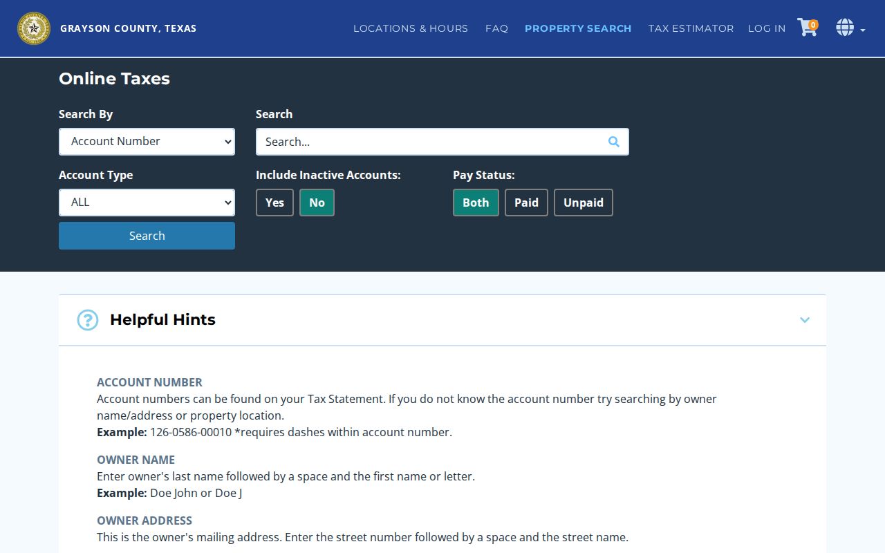
Use the search result as an administrative property record, then compare it with the parcel geometry and the correct jurisdiction layer. The account number format shown by the tax portal includes dashes, while property-location searches do not require a street type or direction.
Sherman ZIP Code Geography
Postal geography and municipal geography meet only after a parcel is identified. The Grayson County Public Interactive Map can identify parcels and display city limits, ETJ, precincts, school districts, and service areas. Its parcel layer supports identify and query and exposes identifiers such as PROP_ID and GEO_ID. Those identifiers are the stronger crosswalk from an address to county appraisal material.
For Sherman zoning or city-jurisdiction context, the city GIS page is the source for the city-limit and ETJ map. The map is useful after a postal search, not as a replacement for a postal authority.
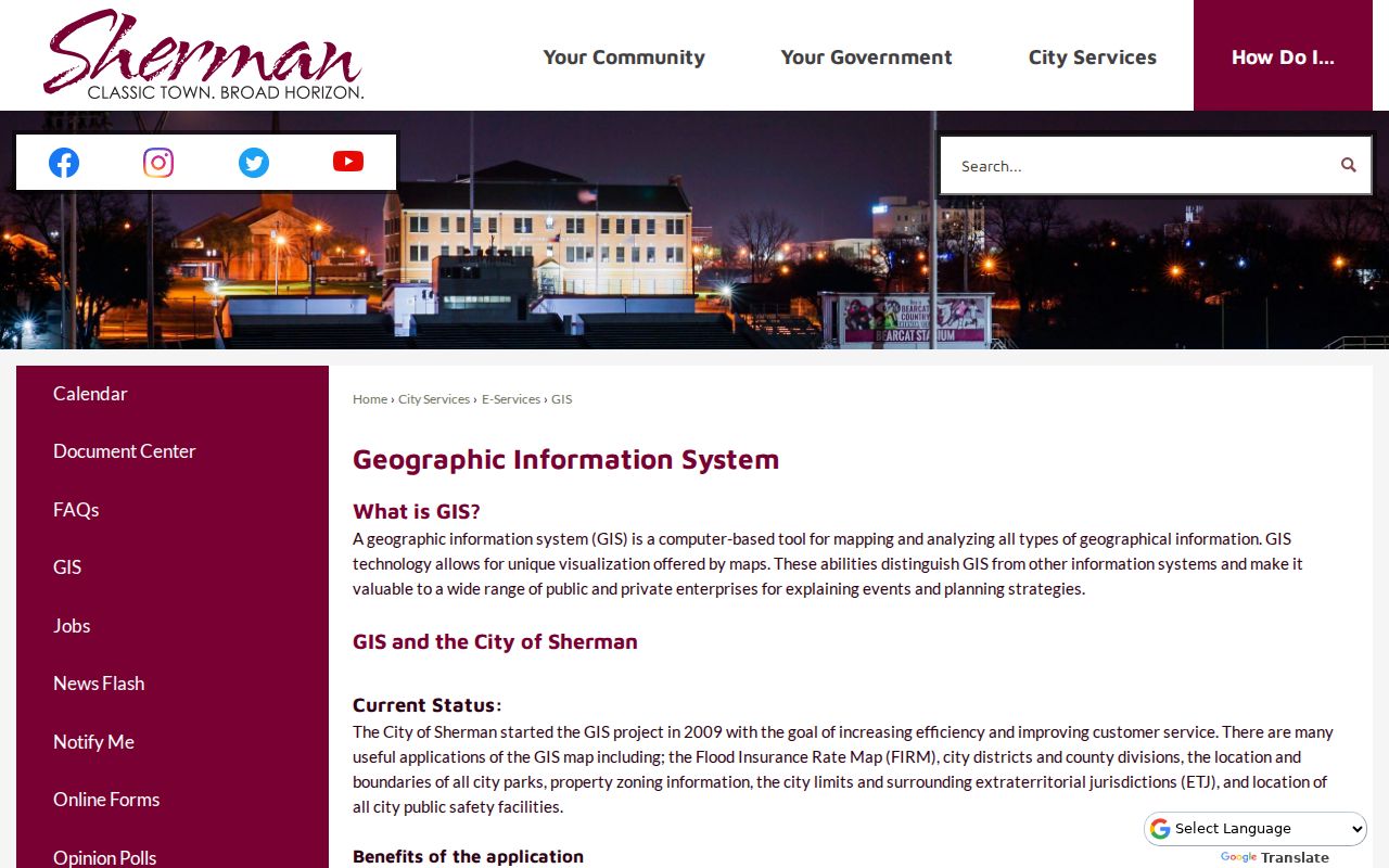
The city’s comprehensive-plan summary describes approximately 47 square miles of city limits and a two-mile ETJ. Annexations can change that municipal boundary, so retain the map date when a ZIP code search is being used to route a city request.
Sherman ZIP Code Jurisdiction
ZIP labels do not decide which records office keeps an item. County appraisal, tax, deed, and GIS records can apply to a parcel whether it is within Sherman city limits, while city permits and municipal-court matters follow their own local jurisdiction. ETJ addresses have a different regulatory relationship from addresses within the city.
Start with the parcel’s city-limit or ETJ layer result. A city-issued permit question can use the appropriate city permit or records route. Property and recorded-instrument questions belong with Grayson County systems, including GCAD property search and the County Clerk official-records portal. A precise request should name the address, parcel ID, record type, and date range.
Note: Save the postal result date and the GIS layer date because both delivery assignment and jurisdiction boundaries can change.
Sherman ZIP Code Terms
Postal terms are easy to overread. They describe mail handling, not property ownership, city incorporation, or a person’s presence. The definitions below keep the Sherman ZIP code directory focused on what the terms can establish. No official source in the research confirmed that any one Sherman-associated ZIP has a PO-box-only or unique classification.
- ZIP code
- A postal routing area used to sort mail. It can cross city, county, or jurisdiction boundaries.
- ZIP+4
- An added four-digit segment that refines delivery within a ZIP code. It does not replace the parcel identifier.
- PO-box ZIP
- A ZIP used for post-office boxes. Its status should be stated only when a current USPS source confirms it.
- Unique ZIP
- A ZIP assigned to one institution or organization. No Sherman-associated unique ZIP was verified in the research.
- Carrier route
- A mail-delivery grouping within a ZIP area. It is not a city-limit boundary or a resident roster.
For a historical address, carry the old street number, legal description, and modern parcel ID together. Sherman moved from its original site in the nineteenth century, and later boundary changes can make a familiar mailing label a poor substitute for the historical record location.
Sherman ZIP Code Limits
The most useful ZIP code result is modest: it helps select a candidate area. It does not prove a city boundary, resident count, household membership, or exact delivery route. Census QuickFacts reports city-level information for Sherman, not totals for individual ZIP codes, so city numbers should never be converted into ZIP population claims.
When a source is unclear, report “associated with the mailing or search result as of” the date checked. If no official address-level result is available, say that current street coverage was not located in official sources. That preserves a usable Sherman ZIP code directory without filling the gap with guesses.