
Sort Sherman Previous Residents by Era
Previous residents are a timeline, not a single database field. A good address history pairs an address-keyed source with a name source, then checks a confirming source for the same period. The county’s land series reaches farther back than the online deed search, while the directory record begins later and follows its own publication rhythm. Start with the era, then choose the sources that were actually available in that period.
| Source | Years it covers | Where held | What it can show |
|---|---|---|---|
| Surveyor’s Record | 1839-1939 | Grayson historic series and TSLAC reels | Surveys, abstracts, and legal-land context. |
| County Clerk deed record | 1846-1915 historic; 1915-present current route | Kofile, County Clerk, and TSLAC | Grantor, grantee, instrument, legal description, and title events. |
| Grayson probate | 1846-present; online search 1983-present | County Clerk and TSLAC | Estate, guardian, heir, and representative clues. |
| Grayson tax rolls | 1846-1910 | TSLAC reels 109101-109112 | Yearly administrative tax and location trail. |
| Sherman directories | Listed and sampled from 1887-88 through 1968 | TSLAC, Portal, and library sources | Address association, spouse, occupation, business, and street context. |
| Sanborn maps | 1885, 1888, 1892, 1897, 1902, 1908, 1914, 1922, 1949 cited | LOC, THC, and library sources | Structure, use, block, and street context. |
| City permits and archive | Current portal from 2025; historic extent not located | Development Services, Archive, and PIA route | Construction, planning, inspection, and address actions. |
| Federal census | Released under the 72-year rule | NARA, Census channels, and library databases | Household and residence snapshot at a census date. |
For the earliest period, begin with deed books, surveyor records, tax rolls, maps, and probate. From the 1890s forward, add Maloney or Polk directory entries and newspapers. For more recent decades, start with GCAD, tax, current Clerk records, and city files, then work back rather than assuming those systems preserve every earlier change.
Start a Sherman Parcel Timeline
Begin an address history in Grayson Central Appraisal District, not with a name alone. Save the Property ID, Geographic ID, legal description, owner field, tax year, and map location for the current parcel. Then use the county GIS layer to confirm parcel geometry and the City Limits or ETJ result. Legal description, lot, block, subdivision, survey, and abstract information are often more reliable bridge fields than an old street number.
The County Tax portal supplies another administrative view. It separates Property Location from Owner Address, account type, inactive status, and paid or unpaid status. Property Location is the situs field for the parcel. Owner Address is a mailing field. Keep that distinction intact in a research ledger because either address may differ from a person’s actual place of residence.
Record one line for each event: source, custodian, record type, date or as-of date, address form, parcel ID, person or party role, and match basis. A parcel timeline makes it much easier to revisit a weak link without turning a tentative clue into a stated fact.
Note: Preserve the tax year and map date with the parcel identifiers because appraisal and GIS fields can change over time.
Trace Sherman Deed Chains Backward
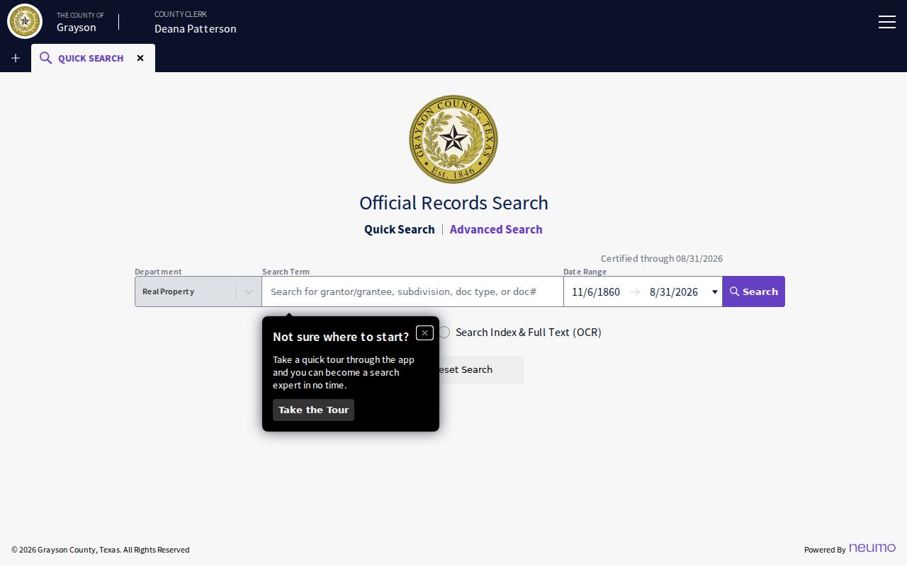
Use the current parcel and the most recent recorded instrument to begin the deed chain. Grayson County Official Records Search states online coverage from 1915 forward. It offers Quick Search and Advanced Search, date ranges, index-only searching, and OCR full-text searching. Search the current owner as a grantee to locate an acquisition, then search that seller as a grantee to find the prior acquisition. Also search each known party as a grantor to locate a disposition.
The official-records screen below is the current portal. It is useful for recorded-party, date, document, and legal-description research, but it does not identify a current occupant.
For each instrument, preserve the grantor and grantee spellings, document type, recorded date, document number, book or volume and page, legal description, and each person’s role. A deed of trust, release, lien, plat, easement, or probate-related filing can explain a change in the chain without proving that a named party lived at the address.
- Locate the current parcel in GCAD and copy the legal description before opening the deed index.
- Find the most recent acquisition instrument by the current owner or legal description, then save its recording details.
- Search the seller from that instrument as a grantee, plus the legal description, lot and block, or subdivision.
- Repeat backward, checking grantor and grantee roles in both directions and flagging estate, trustee, or corporate names.
- When the chain reaches the 1915 boundary, move to Kofile, the County Clerk, and TSLAC rather than treating a modern no-result as the end.
- Grantor
- The party conveying or transferring an interest in a recorded instrument. The role does not establish residence.
- Grantee
- The party receiving an interest. A grantee may be an individual, a business, a trustee, or another legal entity.
- Chain of title
- A sequence of recorded title events traced from one instrument to an earlier one through parties and legal descriptions.
- Legal description
- The lot, block, subdivision, survey, or abstract wording that identifies land more reliably than a changing street address.
Cross Sherman’s 1915 Record Split
The 1915 boundary is a search-method change. The current official portal is for records from 1915 forward. Earlier research uses Grayson’s Kofile historic index, the County Clerk, and Texas State Library and Archives material. Kofile supports Type, Year, Grantor or Grantee party fields, beginning characters for first and last names, and direct Book, Volume, and Page searches. Historic Deed Record coverage begins in 1846, while related series have their own start dates.
TSLAC’s Grayson County microfilm holdings supply the offline route when the historic index or modern portal does not resolve an address. The holdings include deed record reels for 1846-1886, marriage reels for 1846-1911, probate minutes, naturalization, district minutes, and tax rolls for 1846-1910. Some items may be available on-site or through interlibrary loan, depending on the item.
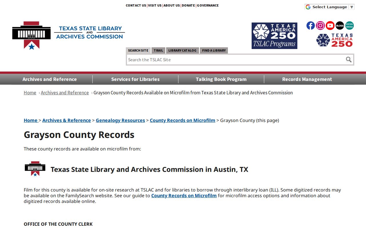
The TSLAC listing notes no volume D or I in the cited deed-reel run. Treat that as a catalog warning, not proof of a missing title event. Check surrounding volumes, the historic index, survey and plat references, and the County Clerk before marking the sequence as a research gap.
Note: Record whether an item is a digitized image, an online index, or only a catalog entry because those access levels are not equivalent.
Pair Sherman Directories With Census
Directories and census records address the household layer differently. The Portal to Texas History offers dated Sherman and Denison volumes, including 1898-99, 1910-11, 1912-13, 1918, 1923, 1925, 1935, 1947-48, and 1950 items or samples. Street pages can show occupants, spouses, businesses, and vacant places. Alphabetic entries can supply a fuller name, occupation, or employer. A census supplies a household snapshot at its release-year date, not a year-by-year address ledger.
Use the directory year to select a nearby released census, then compare the street number, spouse notation, occupation, business address, and neighborhood context. Search adjacent directory volumes as well. A person absent from one issue might have moved, died, been omitted, appeared at a business address, or fallen outside a directory boundary. A new name can be a household member, a business operator, an owner, or a printing error.
- Record the exact address spelling and number from a numerical directory entry, including
r,b, spouse, business, or vacant notation. - Find the same person in the alphabetic section, then preserve the item URL and page number.
- Compare the preceding and following directory volumes before treating a changed name as a move.
- Use the released federal census for a household check, labeling its census date separately from the directory publication date.
- Confirm an ownership event through the Clerk, tax, probate, map, or newspaper record that fits the same period.
For the catalog, publishers, and page-reading details behind these sources, use the Sherman directory book. The key address-history task is comparison across time, not a one-volume name match.
Note: A directory date and a census date are separate evidence dates, even when both sources name the same household.
Separate Sherman Owners From Occupants
Use four labels in a Sherman previous-residents ledger: previous title holder, directory occupant, business occupant, and person mentioned in a property notice. The labels keep the evidence honest. A recorded title holder can live elsewhere. A directory may list a business owner at a business address. A tax mailing address can be outside Sherman. A name in a probate, lien, or permit record may identify a representative or applicant rather than a resident.
Directory notation needs the same care. In the local material, r and b can distinguish residence and business context, a spouse in parentheses is a publisher convention, and “vacant” is a point-in-time statement. Pair the entry with a deed, map, newspaper, or other record that has a clear role and date. Do not merge disparate facts into a single residency claim.
Match Sherman Blocks With Sanborn
The Library of Congress 1885 Sherman Sanborn map provides building, street, block, and land-use context for an older address. Texas Historical Commission material cites Sherman Sanborn dates of 1885, 1888, 1892, 1897, 1902, 1908, 1914, 1922, and 1949. A sheet can show whether a location was a house, store, stable, school, or vacant ground at the map date. It is not a resident roster.
No official Sherman street-renumbering list was located. When an old number fails to match, compare Sanborn sheets, plats, old directory spellings, and deed legal descriptions. Sherman was founded in 1846 four miles west of its present site and moved in 1848, so the earliest land references may not map neatly to a modern parcel. Document the unresolved link instead of forcing a present-day address match.
Note: An older address that will not map cleanly is a research gap until a map, plat, or legal description supports the match.
Audit Sherman’s Courthouse Record Gap
Sherman’s record history has a real preservation question. The courthouse burned in 1930, and a 1936 courthouse followed. That event does not mean every earlier record was lost. The practical question is which specific book, index, reel, or recreated series survives. TSLAC reels, surviving County Clerk series, Kofile scans, newspapers, and Texas Historical Commission documentation provide separate paths for that check.
Before 1930, record survival is series-specific. TSLAC lists Surveyor’s Record from 1839-1939, historic deed material from 1846-1915, probate minutes from 1846-1887, District Clerk minutes from 1836-1893, and tax rolls from 1846-1910. A missing online result should lead to a series-and-volume question, not a broad conclusion that a Sherman address has no history.
Protect Sherman Previous Residents
Past-address research is most useful for family history, estate context, and property history when it preserves dates, source roles, and privacy boundaries. Texas confidential-address protections and the Address Confidentiality Program mean that a public-facing record should never be used to reverse or expose a protected location. Vital records also have their own access rules, and a census or directory result is not permission to publish sensitive details about a living person.
Lawful use. Use a Sherman address history for personal, lawful research and preserve the source date and role. Do not use past-resident information to track, harass, or expose a living person.